Day 16, Pilgrim Spokes – Into Maryland

A beautiful autumn morning in western Maryland and a broken chain

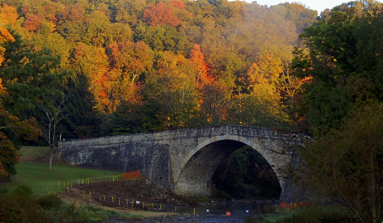
Our morning ride out of Grantsville begins with a stunning sunrise over the historic Casselman Bridge as we pedal out of town, followed by mile upon mile of pastoral surroundings as we make our way toward Cumberland, which is the perfect salve to heal our memories of our “day from hell” on the previous day.

After a hearty breakfast of chicken fried steak in the little town of Frostburg, we glide down into Cumberland, then begin a day of up and down climbing as we make our way along friendly and lightly travelled roads into the town of Hancock late in the afternoon, where we pick up a bicycle trail to follow for five or ten miles. It’s a beautiful ride along the trail with dappled shadows dancing beneath our tires, and it ends too quickly as we find our way back over to US 40. Soon afterwards, Dave breaks a chain as he’s climbing a little hill, offering us our first real mechanical breakdown of the trip all the way across the country. Some minor surgery puts his chain back in shape, and we’re off to complete our ride into the town of Hagerstown.

We find an “all you can eat” Chinese place close to our hotel and enjoy a hearty supper over our daily discussion of the excellent day of riding we just experienced.

A cross-country bicycle adventure is the canvas for this tale of discovery along the winding backroads of America’s heartland. The second book in the “Cycling Reflections” series, Pilgrim Spokes tells the story of the eastern half of the trans-American trek, continuing the saga begun in Neil’s award-winning previous book—Pilgrim Wheels—which reconnoiters the western half of the journey.

More than just a journal of a bike ride across the country, Hanson’s delightful and beautifully written story takes the reader on an engaging pilgrimage of observation and reflection. Often hilarious, sometimes poignant, and always inspiring, it’s a must-read adventure that will stir your soul.

A Bad Road – Cycling US40 in Pennsylvania

Day 34 – St Clairsville to Grantsville – Cycling US40

118 miles, 13:05 elapsed time, 9.5 hours pedaling, 11,400 ft elevation gain, 8400 calories burned

The pre-dawn morning air chills us, up high on a hill overlooking the area surrounding St Clairsville, mounting up for another day in the saddle. The coming sunrise spills warm orange and rich reds across the sky. The view across the hilltops is breathtaking, and we take a few pictures, knowing full well these aren’t the kind of shots that translate into anything other than “ho-hum” if you’re not standing there.

With this chilly air, I’d love to have bit of climbing to warm my joints and muscles as a beginning to the day. However, as soon as we leave town, we begin a two-mile descent steep enough to require quite a bit of braking. It’s cold enough I’m uncertain about potential icy spots on the road as we fall into the coldest air at the base of the descent, where the road crosses the old Blaine Hill Bridge over Wheeling Creek.

The old Blain Hill Bridge after descending through the chilly morning air

It won’t be the last time today I’ll wish for another layer of warmth…

The road follows Wheeling Creek for several miles, meandering through old towns and past 200 years of history few people remember. It’s early in the morning on a Sunday, so traffic is extremely light, giving us a chance to stop and take lots of photo’s as we cross the Ohio River twice. The second crossing uses the old Wheeling Suspension Bridge.

Dave As We Follow The Creek
Dave Crossing The Old Wheeling Suspension Bridge

This is a beautiful old bridge, built in the middle of the 19th century. It spent two years as the longest suspension bridge in the world, and was the first bridge across the Ohio River. Dave and I walk the bridge, taking lots of photos, soaking in the history and beauty of the place.

In Wheeling, we begin to rely heavily on the maps I planned and loaded into my Garmin. Prior to this as we’ve crossed the country, we’ve just used these maps as a backup – something to get us back on track if we stray to far from our route in our meandering. Here is Wheeling, we just take whatever turns the Garmin tells us to take, and are rewarded with a wonderful ride through town, following an excellent bicycle path for several miles along an old railroad grade, dropping us off in Elm Grove east of Wheeling. Continue reading “A Bad Road – Cycling US40 in Pennsylvania”