Portland, Maine

Portland is at the west end of Casco Bay. In summers past, it was just a city to get past for us, and we didn’t spend any time there. This summer we spent a total of two or three weeks in the Portland area, and absolutely fell in love with the city.

First, as to anchorages, there aren’t a lot of options for anchorages right close to town.

The city of South Portland has a free dock they offer for overnights, and this is where Dave, Gene and I tied up when we made landfall after our journey north from Norfolk in June. The dock is at Thomas Knight Park, under the south end of the Casco Bay Bridge. From the dock, it’s a mile walk to laundry and supermarket, so it’s a good place to stop for a day or two. But it’s pretty loud and not the most scenic of spots. Additionally, there always appear to be a few local boats who have decided to take up residence on the dock, making access questionable. You can walk across the bridge to Portland, and Dave actually ended up walking all the way to the Portland airport from here when his Uber ride didn’t show up.

Another option is an anchorage called Simonton Cove, which is on your port side as you sail north into the harbor. We stayed a night there, and if you found a great spot with good holding you could spend extended time there. It looked like beach there, but I have no idea if any of it is public.

This is a problem in Portland—finding public landing areas for your dinghy.

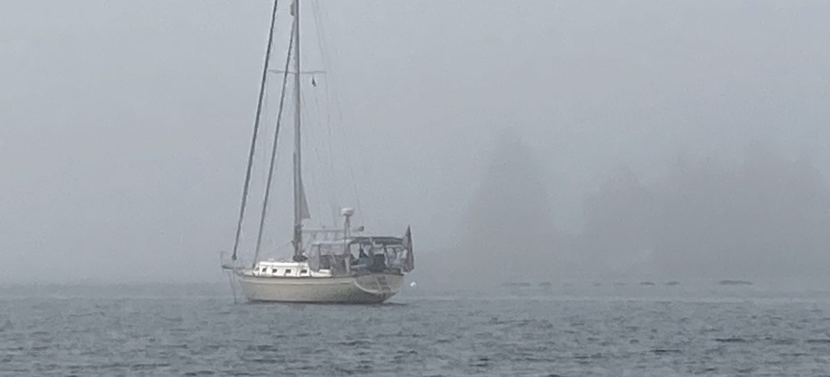
Old Portland was built on a peninsula that extends to the NE. At the far NE end of this peninsula is a hillside sloping down to the bay. This hillside is called the Eastern Promenade (or Eastern Prom). Mostly north from the Eastern Prom, and easily visible from there, is an anchorage that the charts have labeled simply as “anchorage”. We wandered around a bit there, and depths seemed consistent and friendly, though there are several warnings about shoaling in the area. We dropped the hook there twice, and both times the holding was excellent—once through a 35+ knot storm overnight that had the added bonus of large seas rolling in from the S/SE—the one direction with very limited protection.

From that unnamed anchorage, we would dinghy over to the East End Boat Ramp, which is at the base of the Eastern Prom. It wasn’t allowable to tie up to the dock, so we beached the boat in the mud each time. It’s messy, but there were water faucets to clean off muddy feet close by.  It’s also possible to dinghy to Maine Yacht Center marina, which is west of the anchorage. However, they don’t really encourage visiting dinghies, and will charge $25/day for access. They run and outstanding marina though, and we did stay there for about three days over the summer.

The town of Portland is a walker’s dream town. We walked up and down, back and forth, across the entire downtown peninsula several times. Old Port is quite touristy, but great fun nonetheless. Our real love of the town, was along the many streets over the top of the hill, and along the Eastern Prom. Over on the north side of Back Cove, and along the biking/hiking trail that runs the perimeter of the peninsula. All through Munjoy Hill, West Bayside, and the West End.

Most of the time, when we spend a lot of walking time in a town, we end up in neighborhoods that feel a little iffy and dangerous to us. It’s just part of the deal when you explore new towns by foot, especially the towns we’re exploring, which are always old port cities and towns that have been around for centuries. But in Portland, I never really ran across a neighborhood like that. I’m sure they must exist, but I just never ended up there.

Portland is a foodie town. I’m by no means a foodie, but I can say that I enjoyed the food a great deal in Portland. It was the summer and vaccination rates were high in Maine. We felt relatively safe from Covid, as the new variants hadn’t yet moved us back into the danger zone. And overall, Maine is an extremely safe environment. From the beginning of the pandemic, they’ve been responsible and safe across the board. So we took the plunge and ate out several times. My most memorable meal, though, came from a truck.

At the Eastern Prom, along the street called Eastern Promenade, food trucks set up on most days. Some days are busier than others, with more or fewer trucks depending on the day. I found the food from these trucks to be consistently outstanding, and I understand that some famous chefs actually got their start here selling food from a truck. I can confidently say that the absolutely best fish and chips I’ve ever had came from one of those trucks. I sat on a park bench overlooking the ocean, happy people walking by, enjoying a delicacy that I was sure would rarely—if ever—be matched.

It’ll be hard to keep me from Portland on future trips to Maine. Even if it’s only for a day to stroll the Eastern Prom in search of the fish and chips food truck…

Sailing in Maine Fog

As I prepare to post about our 2021 summer in Maine, I wanted to first add a post about navigating in the fog. Because if you’re going to cruise in Maine, you WILL be navigating in the fog, no matter how much you try to avoid it.

Not all the time of course, but some of the time. Our first two summers there I felt like avoiding it was impossible because you couldn’t predict it, but I’ve now come to understand that while avoiding it is still impossible, it IS possible to understand how it works well enough to reduce the amount of time I spend navigating in it.

Navigating in the fog is stressful. I’d like to say that it get’s less stressful over time, and that you get used to it, but that’s not really how I feel. It’s always stressful to me, and while I do feel like I’ve come to understand a few things about it, I never feel like I’m “used to it”.

I’ll start with a quick, two number overview of how fog works. The two numbers to know in Maine are the temperature and the dew point, because when those two numbers meet then you’re gonna have fog. It’s really that simple.

The finesse is understanding exactly where those numbers will meet. The ocean holds a pretty constant temperature, and on a hot day the ocean keeps things cooler, while on a cold day the ocean keeps things warmer. If I’m right on the coast, and the temperature all day will be in the sixties, and the dew point is about sixty, and the ocean water temperature is about sixty, then there is gonna be fog out there on the ocean for most of the day. Land holds heat and is more likely to heat and cool with the days and nights, so if it’s a warm and sunny day the fog will likely thin and disappear the closer I am to land. On a day like this, you can stand on the sunny shore and watch the bank of fog out over the ocean just a few hundred yards away.

While it seemed very random to me my first two years, I’ve come to see that it’s not random at all. The ocean temperature is going to stay constant at something from the mid-50’s to the low-60’s, depending on where you are in Maine. This means that any time the dew point is close to the ocean temperature, the ocean will keep the air close to the water at about that dew point, and there will be fog.

Practically speaking, this explains the phenomenon that cruisers often experience. They’ll leave their anchorage under a clear blue sky on a cool morning. As they get further from land, the fog sets in. They decide to tuck in to an anchorage to avoid the fog, and are worried about getting in to the inlet to the cove in the fog. As they approach the inlet, the fog suddenly lifts. Christine and I said it several times in our first couple years, and I’ve heard many cruisers say something like, “we spent the day in this stressful fog, and were really worried about getting into this little harbor, but amazingly the fog lifted just as we got to the mouth of the harbor.”

From the cruiser’s perspective, it’s not an exact science, but it’s a rough understanding of how it works. It helped us quite a bit in our third cruising season in Maine.

Here’s a fun bonus story. In 2020 (our second season Downeast) we were making our way northeast toward Maine with our friend and crew member Gene. We had made landfall at Block Island, then up Buzzard’s Bay and through the Cape Cod Canal. This is probably the most common route for cruisers to head Downeast. Our target was Boston, where we would drop Gene off and he would make his way back home from there on land.

We’d taken the one mooring ball that was available in Cohasset Cove, which as a very narrow and rocky entrance to a very small harbor, and our plan was to grab the ball right as the day ended and be out at first light.  All went according to plan, but morning dawned shrouded in thick fog. We slowly motored out through the narrow entrance with Gene and Christine watching from the bow, and me watching radar carefully.

This went on for an hour or so, with my brain building an image of what was around us based on the radar feedback laid over the chart on the chart plotter and what we could hear around us. about an hour later, we found the edge of the fog fairly suddenly. I looked up and could suddenly see the world around me through my eyes rather than through the radar screen. What I saw made me panic for a second, and I immediately brought the engine back to idle for a few seconds while my brain brought the two worlds back in sync.

Christine and Gene heard me say something like “oh crap” while throttling back, and asked what was wrong. The visual image they saw didn’t need to get synced with a radar world in their brain. I felt more than a little foolish, probably jabbering something about the land looking too close.

It’s not that one image was wrong and the other was right, but rather that my brain had been creating an image that it expected from the radar images, and when the actual landmarks suddenly appeared to my physical vision, the perspective and perception were off slightly, causing a bit of a short circuit while my brain brought the two images into sync.

I suspect this is a fairly common thing that anyone who uses radar in extremely low visibility situations needs to learn about. I share it here in case it helps any reader learn to anticipate that “oh crap” moment.

By the way, we ALWAYS run the radar when we’re sailing at night. I can’t imagine feeling safe without it. This odd perception thing never happens then (or hasn’t yet), and I think it’s because you do have some visual queues around you at night to keep the two images in sync. When dawn comes, it isn’t a sudden lifting of the veil from 20’ of visibility to miles of visibility, but rather a gradual process that allows the images in our brain to stay in sync.

Happy sailing!